Strats3D · by Greenshift Digital
AI subsurface modelling for geotechnical engineers
From borehole logs to model, design and report. One environment.
Strats3D carries the whole ground investigation workflow: parse the logs, build the 3D model, run the screening designs, produce the report. All of it on the same data, current as every borehole lands.
The pattern
Logs in. Deliverables out.
Strats3D is Greenshift's agentic AI applied to ground engineering. Agents parse the geology, apply cited correlations, and keep the model current as every borehole lands — a live picture of the ground, not last month's interpretation.
Logs in
Borehole logs as Excel, PDF or AGS4 — the formats you already export.
AI structuring
Geology parsed into soil units, correlations applied and cited.
Deliverables out
Model, sections, design checks, report, AGS4, PLAXIS, DXF.
One connected environment
Five packages of work. One environment.
A ground investigation traditionally spans a logging tool, a ground-modelling tool, a suite of design spreadsheets, a finite-element pre-processor and a word processor — with the data re-entered at every hand-off. Strats3D compresses that chain into one connected environment: the ground model, the design and the report draw on the same underlying data, and stay consistent when the data changes.
Replaces · Logging tool
Ingestion and boreholes
Excel, PDF and AGS4 logs parsed by AI into structured soil units you can edit.
Replaces · Ground-modelling tool
3D model and sections
Interpolated contact surfaces, an interactive block model, cross-sections between any boreholes.
Replaces · Design spreadsheets
Design calculators
Foundations, slopes, retaining walls, consolidation and ground improvement, seeded from the model.
Replaces · FE pre-processor
PLAXIS 2D export
A governing section exported as a PLAXIS 2D script, ready for detailed analysis.
Replaces · Word processor
Report builder
Screening and pile design reports with model figures and design results embedded.
The result
One data spine
Change a log and the model, sections, designs and report figures update together. Nothing is re-typed, so nothing drifts.
In the product
The whole chain, on screen
The 3D viewer, analytics and design tabs share one project. Pick a borehole, seed a design, attach the results to the report.
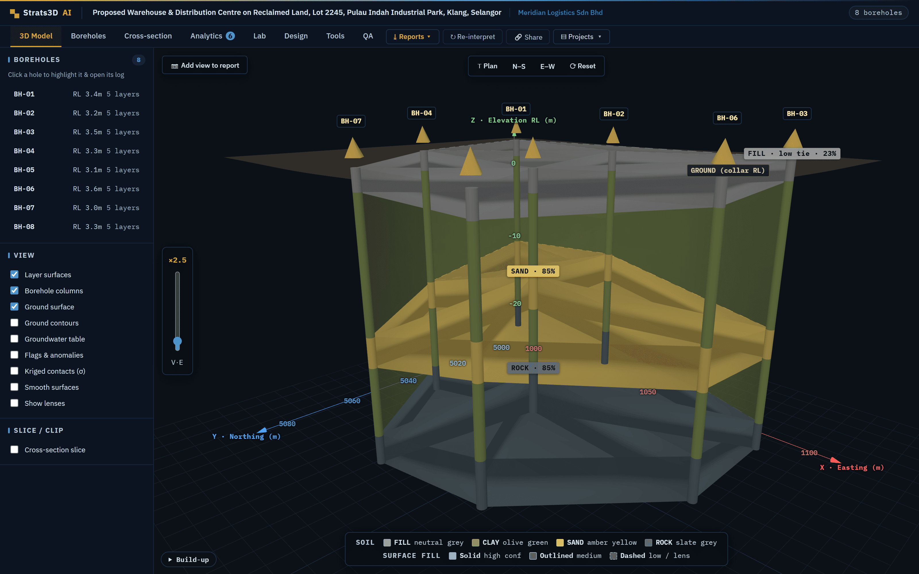
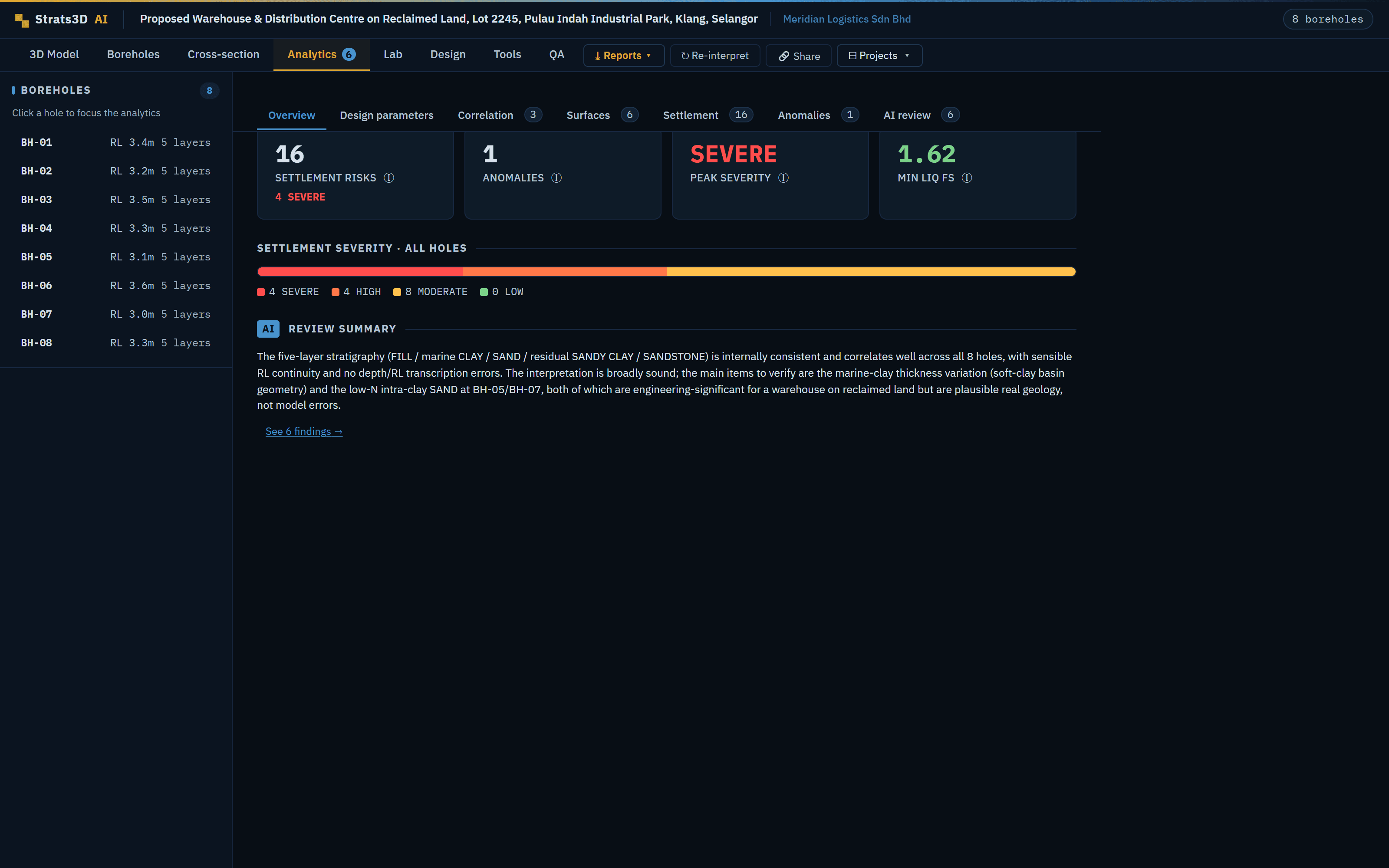
Built on one data spine
- — The soil units the AI parses from your logs drive the viewer, the analytics and the design tabs alike.
- — Design calculators seed their parameters from the model; lab data joins the same project.
- — Report figures are captured from the live model, so the report matches the data behind it.
- — AGS4, PLAXIS 2D and DXF exports carry the same model into your other tools.
Capabilities
What Strats3D does with your logs
Interactive 3D ground models
Turn logs into a model you can rotate, slice and share with stakeholders who do not read logs.
- Layer surfaces, borehole columns, ground surface
- Smoothing and lens volumes where the geology needs them
- Slice, clip and inspect the full block
Trust
Every correlation is documented and cited, drawing on established geotechnical methods (Stroud; Peck and Meyerhof; Skempton). Every output is screening-level and engineer-in-the-loop — built to support the engineer's judgment, not replace it.
Questions
What engineers ask first
What file formats can I upload?
Borehole logs as Excel (.xls, .xlsx), PDF, or AGS4 interchange, plus AGS4 lab data and DXF site plans. PDFs and lab sheets are read by AI; AGS4 comes straight in.
What deliverables can it produce?
A screening report (PDF), a pile design report (.docx) with figures and design results embedded, AGS4 export, a PLAXIS 2D script for the governing section, DXF export, and read-only share links.
Does it replace my detailed design tools?
No — it feeds them. Screening designs scope the problem, then the PLAXIS 2D script, AGS4 and DXF exports carry the same model into your detailed analysis.
Does Strats3D replace the engineer's judgment?
No. Every output is screening-level and engineer-in-the-loop, with correlations cited, so you decide where to look harder. It speeds the read; you make the call.
How current is the model?
It updates as boreholes arrive. Add a log and the model, cross-sections, designs and analytics refine around it.
Who owns the data I upload?
You do. Your logs and models stay yours. We structure them for you, we do not repackage them.